CLOUD APPLICATIONS AND SOFTWARE
MettaGO 360
A mobile and web-based ecosystem that connects your field and office work. MettaGO 360 is a mobile and web platform that centralizes your geospatial workflow. It connects field data collection with cloud-based analysis, enabling you to make faster and more informed decisions.
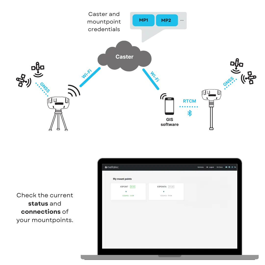
 NTRIP corrections
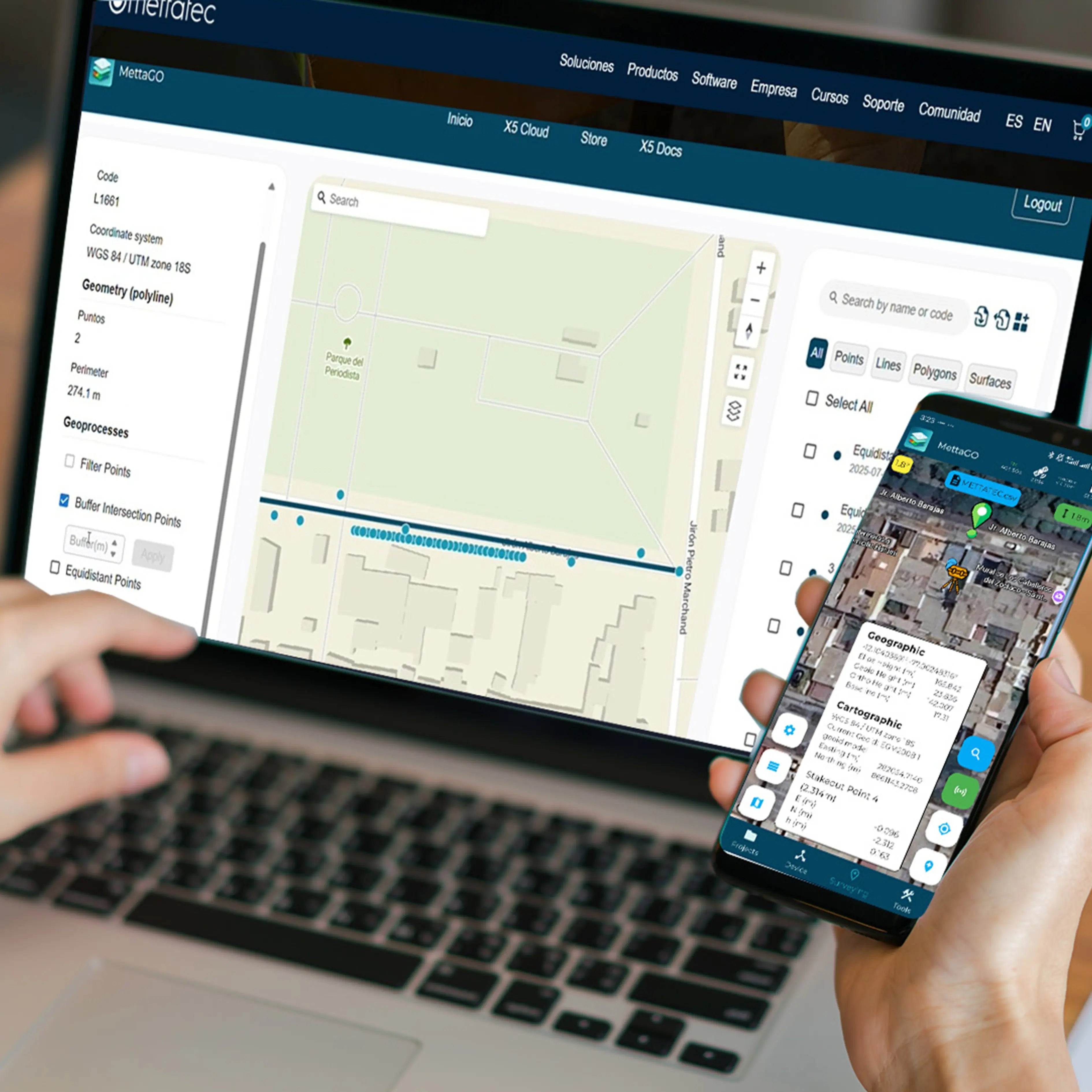
 Processable data
 File formats